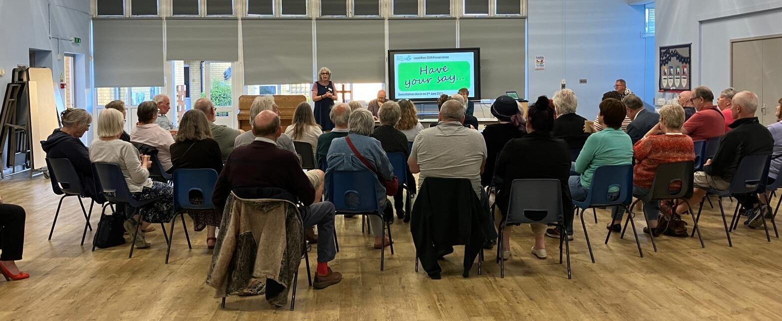
On Friday 10 May over 50 people attended a public meeting where just some of the details of the local plan were put before the audience. Also in attendance were some of our parish councillors, our two city councillors and leader of CCC, Alan Baldock.
At the end of this article you can see outline minutes from that meeting.
Everyone is urged to read and respond to the plan. At over 600 pages, we have put together some guidelines that may inform your response. At the bottom of this page are pdfs of the presentation that was shown.
Respond to the Consultation by 3rd June
There are several ways you can respond to the consultation and make your voice heard.
- Go to https://news.canterbury.gov.uk/consultations/canterbury-district-local-plan-to-2040/ – then click on the questionnaire link found below Have Your Say.
- Send an email to consultations@canterbury.gov.uk
- Reply by post – you can print and fill in the council’s form (72 pages) or just write your own letter and send it to Local Plan Consultation, Canterbury City Council, Military Road, Canterbury, Kent CT1 1YW
If you submit your comments in writing, you must include your name and address and make it clear which policies your comments relate to. The following are the chapters that directly affect our area: Chapter 1 Spatial strategy for the plan, Chapter 2 Canterbury, Chapter 5 -Rural areas :Policies R5 Bread and Cheese Field Westbere, R6 land at Hersden, R9 land North of Popes Lane, R10 the Paddocks, R14 Goose Farm, R15 Shalloak, R16 Mayton Lane and R17 Broad Oak Reservoir refer to the Sturry and Broad Oak developments
If you need a paper copy of the survey, or if you have a need or disability that means you require the document in a different format, please contact Victoria Asimaki, Principal Policy Officer at consultations@canterbury.gov.uk.
Guide to Filling in the Consultation Form- Have Your Say!
The public consultation runs until Monday 3rd June (5pm) and we urge everyone to take part. The number of responses is important to show our strength of feeling. It’s important to base any objections on evidence and policy, not just because you don’t like it. Go to the Consultation Questionnaire online. https://online1.snapsurveys.com/interview/90237d61-ab28-4820-a95c-ed15c8de22b7
IF YOU ONLY HAVE 30 MINUTES SPARE just respond to a few QUESTIONS in the online form or email consultations as above… you do NOT have to complete every section.
YOU MAY FEEL that you wish to comment on overall housing numbers in the plan which can be emailed in as this do not easily fit into the slots provided.
Numbers of housing proposed, whilst reduced, mostly due to the 20% reduction in the length of the plan (from 2045 to 2040, are still considered by many to be too high, as although the government dictates utilising the ONS figures for population from 2014, numerous councils around the country are challenging these figures and claiming “exceptional circumstances “ for their area as a reason for doing so. Population figures have not grown at anywhere near the projected rate in the Canterbury area since the 2014 figures being recommended by the Government as a basis for plans.
Relevant circumstances are: the district’s unusual demographic profile, including the high proportion of students in the local population and the overall decline in indigenous population numbers; the World Heritage Site and its environmental setting; the problems of waste water treatment; and the low building completion rates for several years. Councillors should ask officers to look at the case again.
It has also been commented on by many experienced local campaigners that there is not enough in-depth information to enable proper comments on the developments proposed and you may wish to mention the lack of detail provided.
POSTIVE COMMENTS:
You may wish to advise CCC of any positive aspects of the plan also, as this is helpful in shaping the actions following consultation;
- Lengthening Sturry platforms and obtaining another ticket machine on the other platform
- More emphasis on public transport for the area
- greater emphasis on monitoring and enforcement of planning conditions.
When you’re in the questionnaire, at Q2 tick chapter 5 for Rural areas (Sturry and Broad Oak plans) and chapter 1 and 2 if you wish to comment on the spatial strategy and Canterbury plans
If you are concerned about overall housing numbers for the district, and things like public services, GPs and schools, you should also respond to Chapter 1: Spatial Strategy – Q1 and Q2. Have a look at what these sections say about how “new homes will meet the needs of the district, ensuring the right type of homes are delivered in the right places to improve affordability and support our communities.”
Say what you agree with as well as what your concerns are. What do you think the Strategy for Canterbury should be and why?
RURAL AREAS
Next go to Chapter 5 Rural Areas– to comment on any of the policies mentioned above
BACKGROUND Sturry and Broad Oak are already home to one of the busiest roads in the area (the A28) with the rail crossing having more than 20,000 vehicle movements daily and the bottleneck into Canterbury is not likely to be improved even if the Sturry “relief road” ever comes to fruition. The cumulative effect of current and planned developments in Sturry, Broad Oak, Hersden and those in Herne and Hillborough combine to add substantially to traffic coming through Sturry and Broad Oak on this major route into Canterbury.
Sturry is the village which is most deficient in local space around Canterbury and there is no benefit provided in any of these developments for the community. Lack of sports provision and open space is a serious issue for the well-being of the proposed much expanded population.
PROPOSED DEVELOPMENTS’ IMPACT
Whilst most developments proposed are small ones, R9 (land North of Popes Lane) is for up to 120 homes and R14 at Goose Farm includes 1880msq business creating a significant increase in traffic (planning sources state average 7 vehicle movements per day per household)
- Say what you think about the effects on traffic and roads in Sturry and Broad Oak. Mention any evidence you have from your own experience.
- How workable do you think it is for the Sturry Relief Road (cost now estimated at £41.6million) to improve traffic flow as it rejoins the A28 before the Southern water treatment site?
- How safe or suitable are the roads for more traffic? Mention any evidence you have about road safety.
- Consider the effect on the air pollution in the area due to the considerable increase in traffic.
- Consider bus and rail timings and fares in the area and their impact on your travel choices
- Say what you think about the impact of the proposed developments will be on the school, the doctor’s surgery and pre-school.
- Current approved housing will equate to 2,640 more resident (1100 x 2.4) and another 374 are proposed in this LP and no expansion of provision is planned for the
- Mention any evidence you have of current capacity and experience
- Say what you think about the loss of arable land
The proposed developments would mean the loss of more areas of “best and most versatile” Grade 2 and Grade 3 agricultural land (scored out of 5). The Local Plan includes a policy to protect the best quality agricultural land outside of urban and settlement boundaries but the sites proposed are being classed as inside the boundaries or an allowable extension. It is particularly important (with war and rising costs ) to retain as much arable land as possible.
FROM LP5.18 Sturry is a Rural Service Centre which benefits from numerous services including two primary schools, a number of local shops, a library, dental surgery and cafes/pubs. Regular bus routes run through the settlement providing connections to Canterbury, Herne Bay and Thanet. Sturry train station also provides a direct link to London Victoria. This information is no longer accurate
5.19 Sturry has seen very significant levels of growth through the Canterbury District Local Plan (2017), and the Sturry Relief Road is due to be delivered in the coming years. More limited development is now proposed, together with an extended Green Gap between the settlement and Broad Oak. There is no evidence for this EXTENDED green gap..
R9-Land North of Popes Lane (120 houses)
- Loss of 9ha of long-used arable land for productive crops(wheat, barley, oil seed rape) needed for vital local food production
- The treated water outfall to run off into the Sarre Penn.
- Extremely well used footpath on East side of the field adjacent to the ancient woodland (popular walking spot for many in the local community as Sturry is deficient in open space) would become an emergency access route passing a sewage treatment plant
- Increased traffic and lorries emptying sewage treatment plant
- Potential odour and flies form sewage treatment plant
R10 the PADDOCKS (50 houses) at Broad Oak
R14 Goose Farm (26 houses) AND Provision of business space (minimum 1,880sqm);
R16 MAYTON LANE (8 houses) at Broad Oak
R17 Broad Oak Reservoir
5.32 The proposed reservoir and country park to the north of the village will provide a significant asset for the local community with pedestrian and cycle routes, leisure facilities, water sports, an educational centre, birdwatching, sensory trails and picnic areas.
- Proposal to create Broad Oak Reservoir Country Park covering some 440ha.
- Loss of huge area close to Sturry and Broad Oak villages providing walking routes for villagers lacking in public open space
- To attract high volume of traffic to an already busy area with overstretched roads
R5 Bread and Cheese Field (150 houses)
Many of these proposed developments appear to being brought forward in order to contribute to the hugely expensive (£41.6 million) Sturry relief road, a road which is questioned by many as to its potential effectiveness as it will feed back into the bottleneck of the A28.
5) Water and Sewage
- Sturry Road water treatment centre at capacity and no planned expansion until 2030
- Wastewater treatment plants on each development are not likely to encourage sales and could lead to problems with odour and flies (R9 proposal)
- More traffic and lorry movements will be necessary if order to remove waste (R9 propsal)
6) WILDLIFE
- Acid grassland loss
- Potential damage to Sarre Penn
- Loss of habitat -Slow worms, bats, Newts, Nightingales all know to be present around Popes Lane and Broad Oak
5) CUMULATIVE IMPACT OF ALL DEVELOPMENTS IN OUR AREA…
Write about what you think the developments proposed for our area cumulatively would do to this area of and the distinct villages of Sturry, Broad Oak, Westbere, Hersden and Fordwich
- Our experience of developments here -water leaks, no lighting for 9 months, moved bus stops with no notice, unsafe pavements, dirty roads etc etc….
- A total of 374 houses in addition to the 1150 already approved.
- Broad Oak reservoir -2033-36 proposed as a leisure facility attracting much extra traffic to an already saturated area
- Extended use of the landfill site
- Goose Farm -1880 sq m of business use (associated truck movements, deliveries etc)- no detail as to proposed usage
- Loss of farmland and countryside when Sturry is already the least well served village around Canterbury for public open space. Whilst locals often use public footpaths on farming land not categorised as public open space, these current amenities, important for well-being will be altered for ever by many of these proposed developments.
Developers only build what they think they can sell…
Alan Baldock
If need goes down, we’ll try to build less
We are listening
A reminder of ways you can respond to the consultation and make your voice heard.
- Go to https://news.canterbury.gov.uk/consultations/canterbury-district-local-plan-to-2040/ – then click on the questionnaire link found below Have Your Say.
- Send an email to consultations@canterbury.gov.uk
- Reply by post – you can print and fill in the council’s form (72 pages) or just write your own letter and send it to Local Plan Consultation, Canterbury City Council, Military Road, Canterbury, Kent CT1 1YW
Use your arrow keys to navigate through the document.
If you would like a copy sent to you by email, please contact info@sabora.co.uk
And finally
Here is a link to some excellent background reading that planners are urged to follow
MINUTES Local Plan meeting Sturry Primary School 10th May 2024, 7pm
Attending: approx. 43 inc Sabora Team; David Wadmore, Peta Boucher, Ann Davies, Peter Campbell, Roshna Ahmad, Lynn Burnett, Trevor Pilbeam, Fred Tassell, Freda Tassell, Heather Stennet, Peter Reynolds
Present from SPC -Heather Tayor and John Hogben, Ken Dekker (Clerk),
Councillors: Alan Baldock (leader CCC), Harry Mackenzie and Keji Moses
INTRO : Peta B -welcome
DW– meeting and presentation the work of many on the team to present effect of planned devts on our area -Direct and Indirect effect
HAVE YOUR SAY!
Map shown of all planned devts in the area -housing and business and reservoir
Slides shown of all devts in area (David talked about these areas)
R10 -Paddocks -50 hs
R16 -Mayton -8 hs
R15 -Goose Farm 26 hs and 1880 sqm business use
R9 -Popes Lane -110-120 houses -loss of arable land
R15 -Shalloak Rd -12 hs
R5 -Bread and Cheese field -150 hs
(R6 Hersden not shown but will have indirect effect-18)
Last local plan -1100 approved (B Oak 456 -in progress and Sturry -outline approval given for 600+)
Explanation of population growth in area bring lower than expected and crucially below that in the 2014 Office for National Statistics projections used to plan Local Housing Needs.
Question : Where are the affordable homes
Questions: Are these building targets achievable (currently achieving 50% of planned numbers)
PETER Campbell on TRANSPORT STRATEGY
Welcomed the fact that the transport strategy has cancelled the zoning and Eastern bypass plan and that there is a vision for more sustainable journeys
Vision and reality are at odds however .. carrot and stick approach being taken
Carrot -new cycle routes, improvement to bus services and reallocation of road space (bus lanes etc) -40-60 years of public policy encouraging people away from public transport and into cars needs reversing.
Stick -amount of Parking in centre reduced, Parking costs to rise, segregated road space
Cycling –proposed routes seem lacking in logic I.e. Sturry -Bridge very long roundabout route . Disappointing not to see change to A28 Sturry to Cbury included and improved as this is very dangerous and hence hardly used as cycle route
Bus-led strategy to be welcomed with “soft” improvements such as better bus stops, more info and better accessibility -1 in 5 in Sturry do not have access to a car!
Sragecoach is a commercial organisation so rural buses would need subsidy ..Section 106 funding needed to pay for bus-led strategy –
HOW WILL BUS-LED STRATEGY BE FUNDED? No explanation in plan
- City hoppers needed
- Sturry platform lengthening positive plan
- Sturry rd bus lanes
ANN DAVIES -Open Space
IN LP, Sturry’s deficit of Open space is incorrectly calculated by CCC as Thornden Wood is included as a public open space -Too far to be accessible – Sturry has 0.5ha per 1000 population, less that all other villages
Sports field and play omitted from Sturry’s open space assessment by CCC also meaning it is even more deficient than calculated!
Sturry-categorised as Rural service centre
B Oak as Local service centre
Q’s -Why is it measured incorrectly
Why are sports and children’s play omitted from our open space assessment
Sports -Sturry has to use Brett’s land (often water-logged)for their only pitch -not future proof as could be developed and they have to pay to use pitches elsewhere!
CCC includes private pitches in sports assessment -JKS and Sturry primary -NOT PUBLIC
Qs– Why are school pitches included in assessment
Why is access to pitches not considered?
Why has adoption of new facilities by the PC not been considered?
Why does strategy not address tendency towards small pitches when consolidation of sites would be more financially and socially sustainable?
BUILDING for a HEALTHY LIFE –a design toolkit for neighbourhood -recommended document -available online.
PETA B -SUSTAINABLILITY and ENVIRONMENT
Sturry at junction of A28/A291 -one of busiest rail crossings in the country
Traffic very heavy -Thanet many devts and H Bay and locally new devts all add to this and to air pollution
Heavy traffic -many lorry movements due to sewage removal from H Bay and Goose Farm and Shelford Landfill affect our area
Doctor surgery -at capacity
Well-being affected adversely by
- Lack of sports/play facilities
- Limited access to open space
- Roads splitting community (both A28 and A291)
- Lack of available nursery space
- Low water pressure
- Water treatment works at capacity (led to sewage emptying lorries using A28 and A291)
- Reservoir (advertised a lovely facility) would lead to huge traffic impact on small area and remove arable land and local walking routes
- Cumulative impact of all developments locally all contribute to effects above
QUESTIONS
Trevor P –comment on the numerous football teams in Sturry (9) all lacking local much -needed facility -Spires currently used will no longer be available next year
Brigitte-why have promised contributions in last LP not been adhered to -new doctor surgery etc ?
Alan B- new developments will include contribution and CCC are appointing a senior planning office to monitor all CIL and S106 contributions are fulfilled but no control over past decisions..also a planning sub-committee will operate to carry out tasks allotted by planning committee
Peter C—commented that current developments in area lost contributions as so much was allocated to put towards the “relief road” -this could otherwise have supported the community needs
Alan B -New sustainability standards introduced re being carbon neutral etc for new devts
Please send positive comments also for anything you agree with
LP must go through by June 25 in order to prevent lack of control of use of sites
Peter R– pleased local govt present at the meeting but seems to be a disjointed approach by CCC to housebuilding
Alan B – legal advice taken on housing numbers proposed and assessment of Housing need -cannot use “exceptional circumstances”
Currently 2014 population figures used by govt to dictate numbers -if these go down during life of the LP CCC can build less
WE are listening -do respond to consultation
Peta B –can Sturry/Broad Oak ask for the type of housing the community needs rather than the large houses the developers favour?
Alan B –yes
Q-Why are there so many empty houses?
Alan B –Developers only build what they think they can sell
New LP to 2040 and expected to be renewed every 5 years -as constantly evolving, numbers can be reduced if things change in population
Roshna –Concern over relationship between KCC and CCC following personal experience with SABORA constantly trying to get answers to issues with developers and KCC being very unresponsive… also Transport strategy KCC vs CCC
Alan B –KCC must follow trends to support more public transport and sustainable principles .
Q -date of reservoir-2033 on slide -lived here for 55 years and was discussed then
David W –date available publicly states completion by 2033
Nick B(CPRE) –garden city devt principles recommend “capture of enhanced value”
How does CCC pass builds such as the B Oak flats recently completed?
Alan B –was in opposition when these were passed
PETA B -thanks to all attending and to Alan Baldock for answering questions
POSITIVE -SABORA trying to help build community, funds needed to carry out our work.. do sign up
EVENT -JULY 14th -church, SABORA and twinning committee-do come!
MEETING ENDED 9PM
Leave a Reply